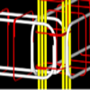
A program for adding contours and 3D terrain models to maps
A program for adding contours and 3D terrain models to maps
Vote: (15 votes)
Program license: Trial version
Developer: Infycons Creative Software Private Limited
Version: 6
Vote:
Program license
(15 votes)
Trial version
Developer
Version
Infycons Creative Software Private Limited
6
Pros
- Supports multiple file formats for diverse total stations
- Comprehensive section creation and volume calculation
- High level of detail in maps and modeling capabilities
- Unlimited template for varied road design projects
- Advanced editing and reporting features
Cons
- Potentially steep learning curve for new users
- May require a robust system for best performance
AutoPlotter with Road Estimator: A Comprehensive Surveying Solution
AutoPlotter with Road Estimator is a robust civil engineering software that is designed to simplify the surveying and road estimation process. This software has been widely recognized for its ability to produce detailed topographical maps, contour lines, 3D terrain models, and accurately estimated road layouts. Its versatility and precision have made it a popular choice among professionals involved in route and topographical surveying, mining, city planning, and various infrastructure projects.
Effortless Plotting and Estimating
The core functionality of AutoPlotter with Road Estimator lies in its seamless generation of cross sections from survey data, accompanied by meticulous earthwork quantity calculations. This process is known for its precision and aligns with the needs of engineers and surveyors who require accurate measurements and estimations for their projects.
Extensive File Compatibility
AutoPlotter with Road Estimator stands out by supporting a wide array of file formats that are commonly generated by different total stations, such as Pentax, Trimble, Sokkia, Topcon, Nikon, and Leica. Users can import data in ASCII, DXF, and DWG formats, which ensures that the software can be integrated into various workflows without compatibility issues.
Diverse Surveying Features
With this software, you can generate both longitudinal and cross-sections using XYZ, chainage, offset, and level data. An inbuilt editing interface allows for detailed section manipulation, ensuring users have control over the fine-tuning of their sections for high-quality outputs. The program's ability to generate contours at user-defined intervals makes it incredibly useful for creating high flood level (HFL) contour maps across diverse survey types such as random, radial, or grid.
Volume Calculation and Reporting
One of the standout features of AutoPlotter with Road Estimator is its depth in volume calculation. It facilitates volume assessment between surfaces, which is invaluable for stocktaking, with the ability to define boundaries as needed. The software also offers comprehensive calculation reports for road volume estimations, enhancing the suitability for construction and planning projects.
Customization and Road Design
What sets AutoPlotter with Road Estimator apart is its adaptability. With an unlimited template database, users can design multilane highways, service roads, and more, with inbuilt elements such as drains and retaining walls. You can also create custom shapes to fit specific project requirements. Users benefit from features like auto-detection of existing roads for overlay construction and auto-calculation of Profile Corrective Course (PCC).
Advanced Design and Data Display
Design elements such as vertical profiles, target level calculations, and symbol creation for crash barriers or trees add depth to the project design phase. The software maintains the creation order, detects existing side slopes, and allows for interpolation of camber and superelevation. Moreover, users can customize coordinate tables and display numerous dimension sets in the cross-section view. Details like depth, camber, toe markers, and grids are also presentable for clarity.
Conclusion
AutoPlotter with Road Estimator goes beyond basic plotting to offer a suite of advanced features conducive to detailed planning and precise execution of civil engineering projects. Although it is packed with functionality, first-time users might face a steep learning curve, but the benefits of mastering this tool are substantial.
Pros
- Supports multiple file formats for diverse total stations
- Comprehensive section creation and volume calculation
- High level of detail in maps and modeling capabilities
- Unlimited template for varied road design projects
- Advanced editing and reporting features
Cons
- Potentially steep learning curve for new users
- May require a robust system for best performance